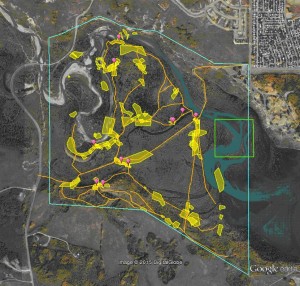
Thanks to all who helped track winter flocks of chickadees in the Park earlier in the year. his map shows the chickadee ‘hot-spots’. Anyone interested in looking into the data in more detail – get in touch! (weasel@theweaselhead.com) We recorded the number of Black-capped chickadees and other species in each flock and followeded them around their territory as they foraged….:
Blue line = boundary of the Weaselhead; Green square = typical chickadee territory of 10ha (4 – 40ha territories have been recorded): Pink teardrops = places with seed (from people) almost always present (other places had seed sometimes); Orange lines = trails; Yellow polygons = areas we found then tracked a flock before loosing it.

